
3 Topographic Elevation Maps
DOWNLOAD NOW Report
182
1
YOU MAY ALSO LIKE:


PSSST - Get this product at a discount as part of the definitive texture bundle: https://crmrkt.com/oGzDq
---
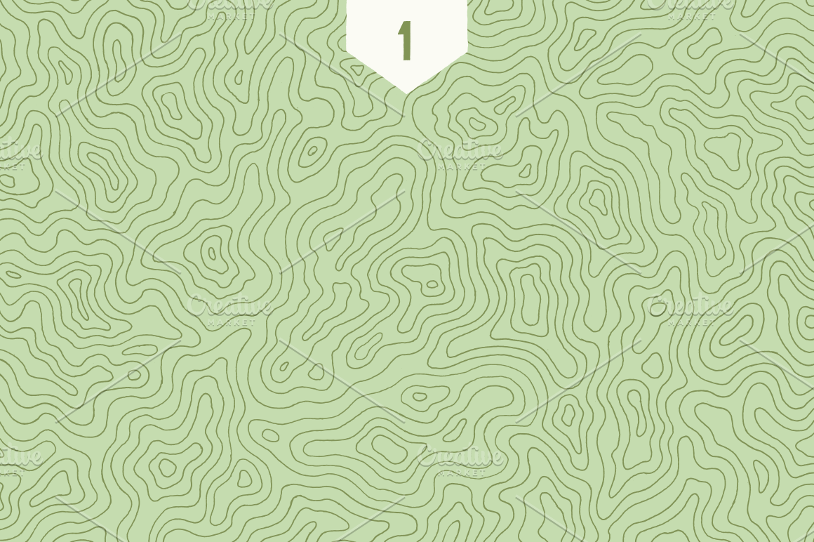
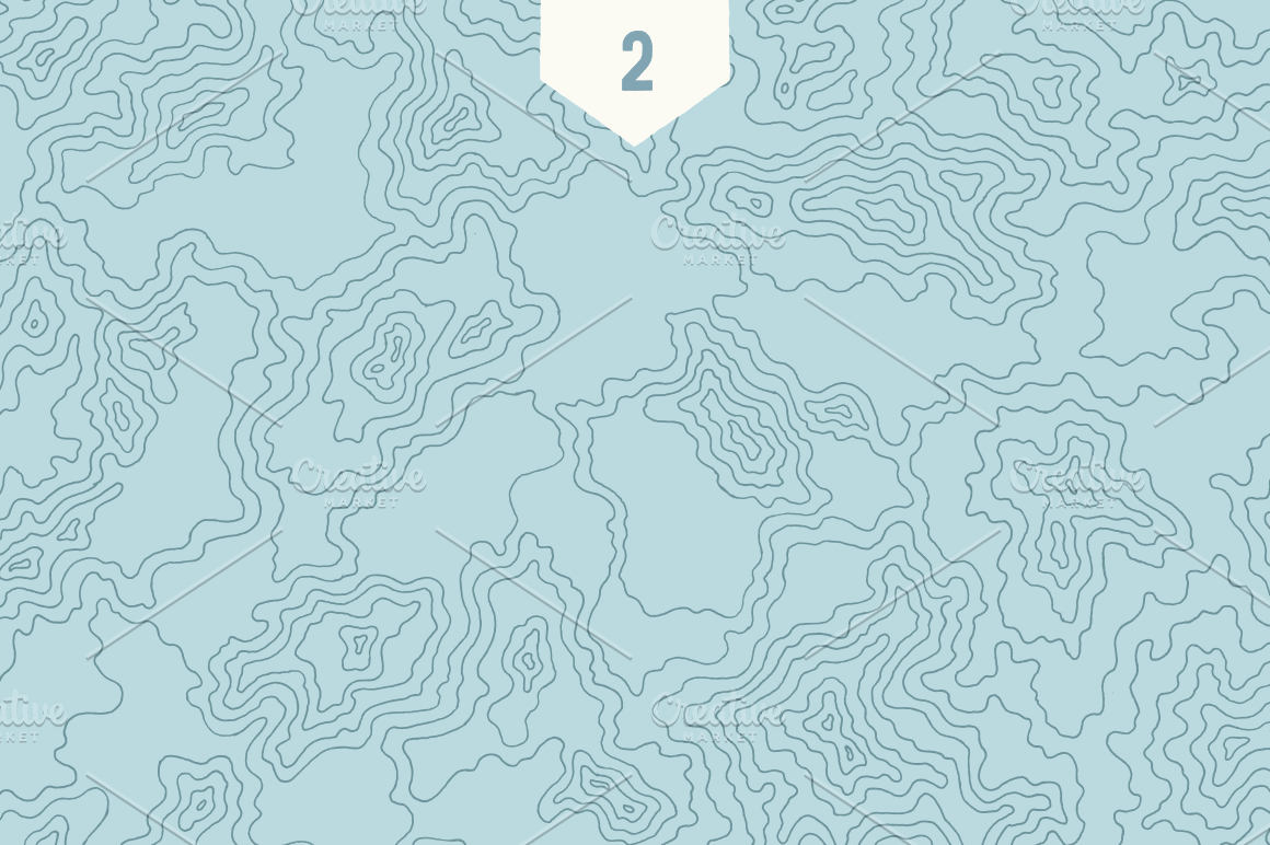
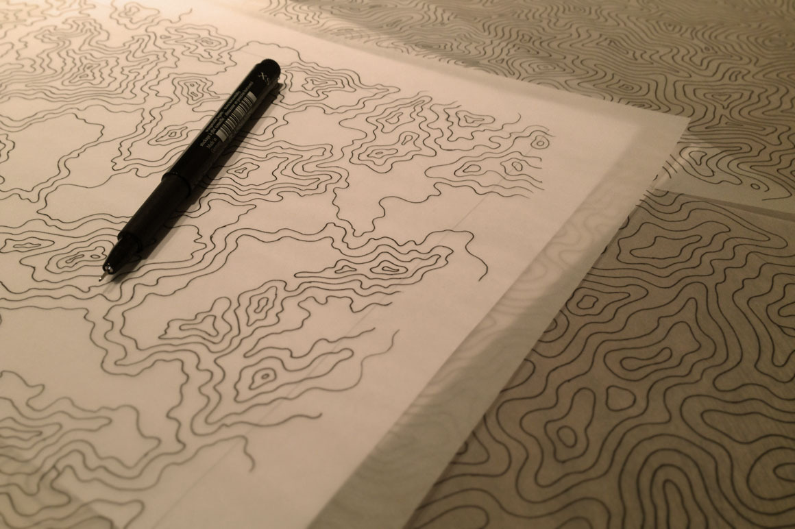
This collection of 3 individual topographic/elevation maps where drawn 100% by hand. The illustrations where then scanned in and exported to vector EPS. The result is an extremely high-resolution set (48 Megapixels in PNG format!). The pieces maintain the subtle, organic imperfections that can only result from being drawn by hand. The time investment to create each image was approximately 4 hours each.
**What's included:**
- 3 individual full-page, hand-illustrated map illustrations
- Each illustration is offered as an 8.5x11 EPS, and also 8000x6100 px (48 megapixels) transparent PNGs
- Each illustration features dark gray lines over completely transparent backgrounds
*Textures do not tile or repeat*
---
This collection of 3 individual topographic/elevation maps where drawn 100% by hand. The illustrations where then scanned in and exported to vector EPS. The result is an extremely high-resolution set (48 Megapixels in PNG format!). The pieces maintain the subtle, organic imperfections that can only result from being drawn by hand. The time investment to create each image was approximately 4 hours each.
**What's included:**
- 3 individual full-page, hand-illustrated map illustrations
- Each illustration is offered as an 8.5x11 EPS, and also 8000x6100 px (48 megapixels) transparent PNGs
- Each illustration features dark gray lines over completely transparent backgrounds
*Textures do not tile or repeat*
| Compatible with: | Adobe Photoshop, Adobe Illustrator, Adobe InDesign |
| File Type: | PNG, EPS |
| File Size: | 14.23 MB |
| Dimensions: | 8000 x 6100 px |