


Vector Maps of Europe
in Graphics / Illustrations
DOWNLOAD NOW Report
125
2
YOU MAY ALSO LIKE:


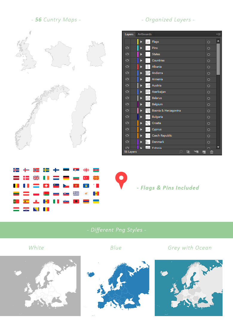
This pack contains vector maps of the European continent. You can use the full map or each country separately. Includes eps & png files for each country. Different styles and colors including grey, blue & white png files. Organizes layers with country names and states. You can also find flags for each country and map markers.
**Europe Maps Included:**
- Whole Continent of Europe
- 56 Separate Countries & States
- Eps & png Files for Each Country
- Different Styles
- Organized Illustrator Ai File
- Adjustable Stroke Width
- Ai, Eps & Png
---
Countries & Stated Included:
Albania, Andorra, Armenia, Austria, Azerbaijan, Belarus, Belgium, Bosnia-Herzegovina, Bulgaria, Croatia, Cyprus, Czech-Republic, Denmark, England, Estonia, Faroe-Islands, Finland, France, Fyrom, Georgia, Germany, Gibraltar, Greece, Guernsey, Hungary, Iceland, Ireland, Isle-of-Man, Italy, Jersey, Kosovo, Latvia, Liechtenstein, Lithuania, Malta, Moldova, Monaco, Montenegro, Netherlands, Northern-Ireland, Norway, Poland, Portugal, Romania, Russia, San-Marino, Scotland, Slovakia, Slovenia, Spain, Sweden, Switzerland, Turkey, Ukraine, Vatican-City & Wales.
---
| Compatible with: | Adobe Illustrator |
| File Type: | PNG, EPS, AI |
| File Size: | 30.6 MB |