


USA & States Vector Maps
DOWNLOAD NOW Report
170
0
YOU MAY ALSO LIKE:


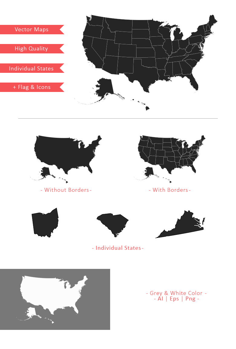
This pack contains high quality vector maps of USA. Includes full map with borders or without. Individual States in different colors, grey and white. Adjustable stroke width and individual eps files for each state. This pack also contains a bonus of USA vector flag, map marker icons & useful navigation icons.
Update:
- Flag & icons now available in png format
- V2.1: Added 25 map elements
---
**USA Maps Included:**
- USA Maps With & Without State Borders
- Individual State Maps
- Ai, Eps & Png Files
- Each State Available in Eps & Png
- Dark Grey and White Color Maps
- USA Flag and Other Icons
- State Codes for Eps & Png Files
- Full Map Png Res.: 1300x900px, 2600x1800px, 3900x2700px, 5200x3600px & 6500x4500px
---
**51 States Included:**
Alabama, Alaska, Arizona, Arkansas, California, Colorado, Connecticut, Delaware, Florida, Georgia, Hawaii, Idaho, Illinois, Indiana, Iowa, Kansas, Kentucky, Louisiana, Maine, Maryland, Massachusetts, Michigan, Minnesota, Mississippi, Missouri, Montana, Nebraska, Nevada, New Hampshire, New Jersey, New Mexico, New York, North Carolina, North Dakota, Ohio, Oklahoma, Oregon, Pennsylvania, Rhode Island, South Carolina, South Dakota, Tennessee, Texas, Utah, Vermont, Virginia, Washington, West Virginia, Wisconsin, Wyoming.
| Compatible with: | Adobe Illustrator |
| File Type: | PNG, EPS, AI |
| File Size: | 19.17 MB |