
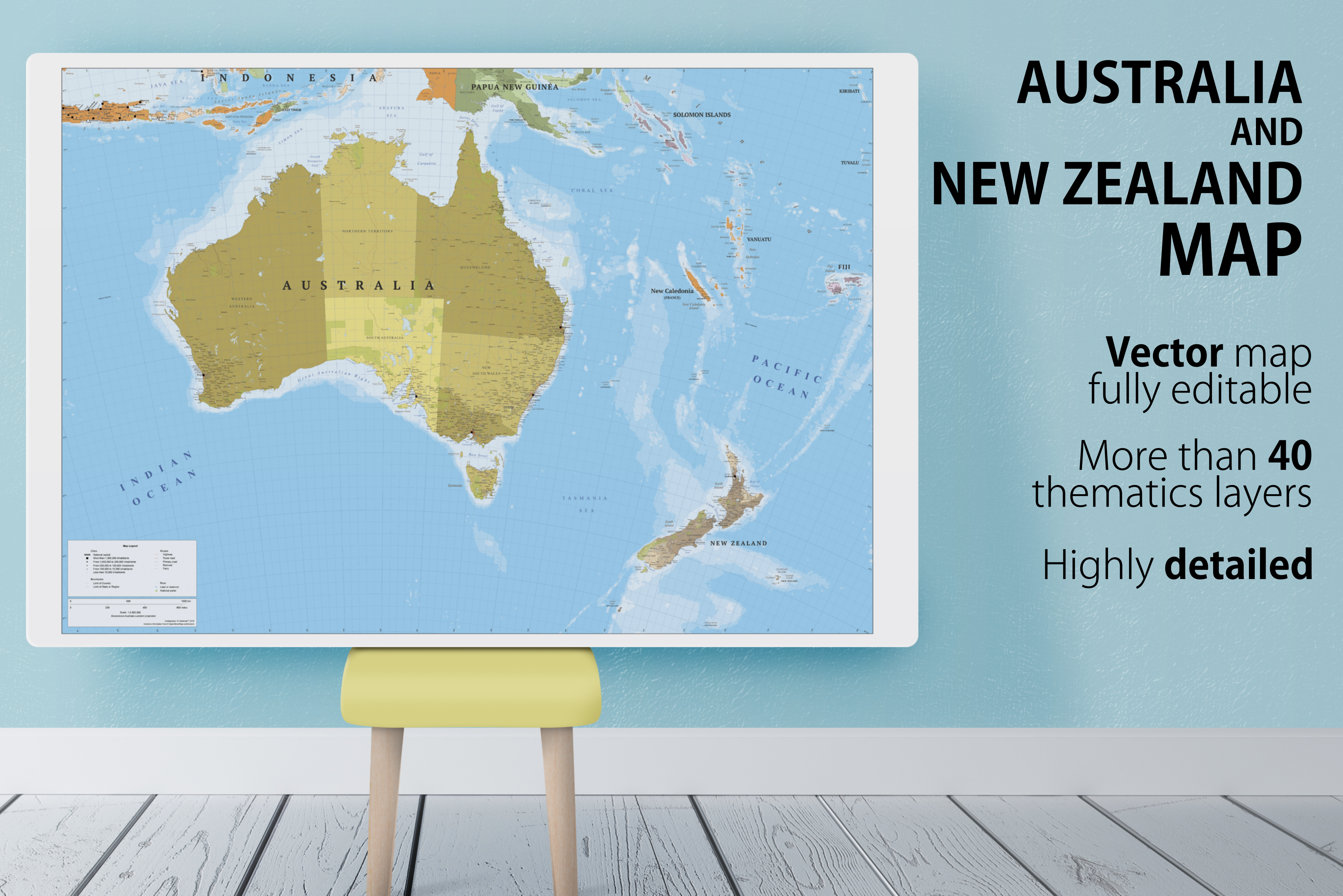
Australia and New Zealand map
in Graphics / Illustrations
DOWNLOAD NOW Report
194
0
YOU MAY ALSO LIKE:


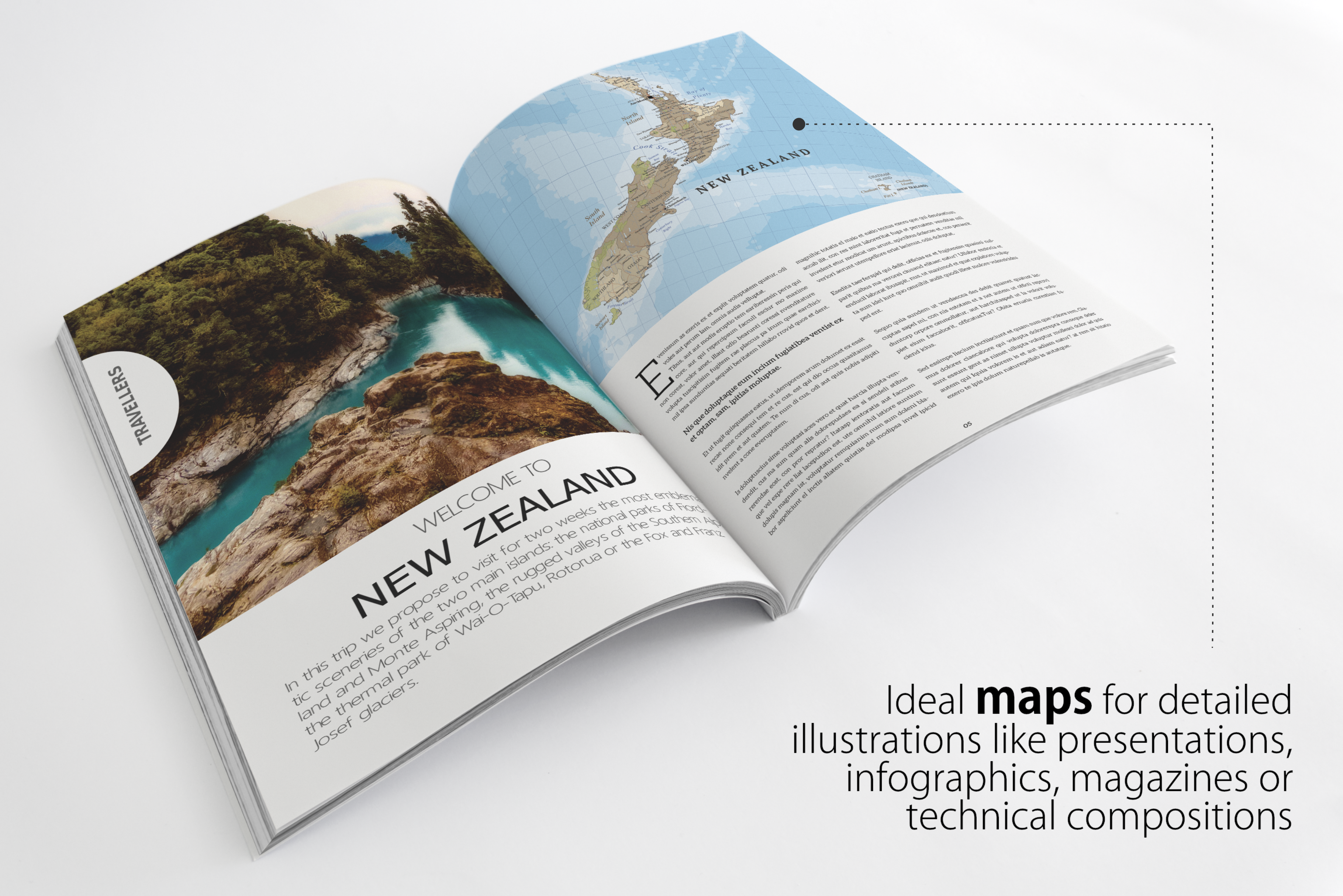
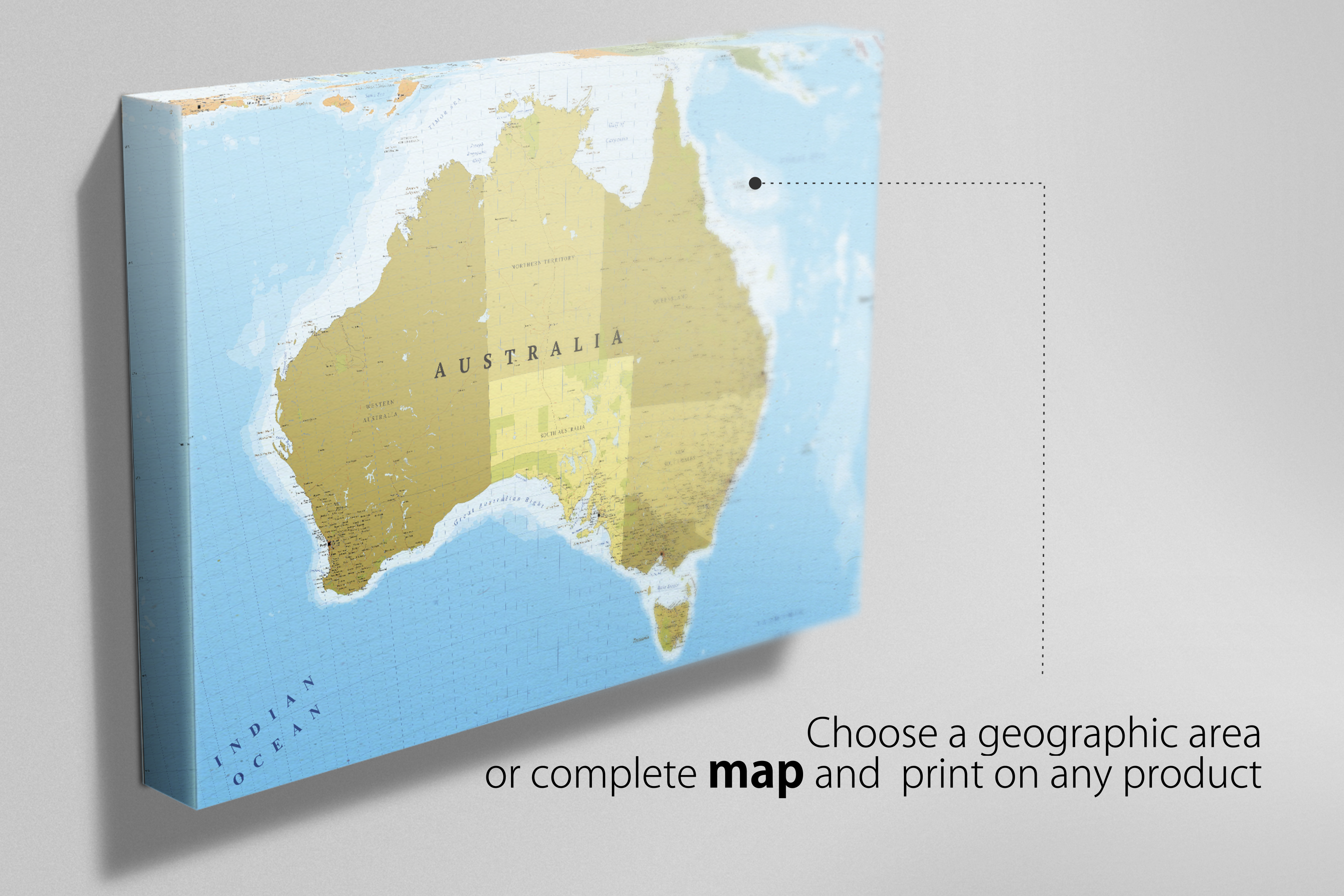
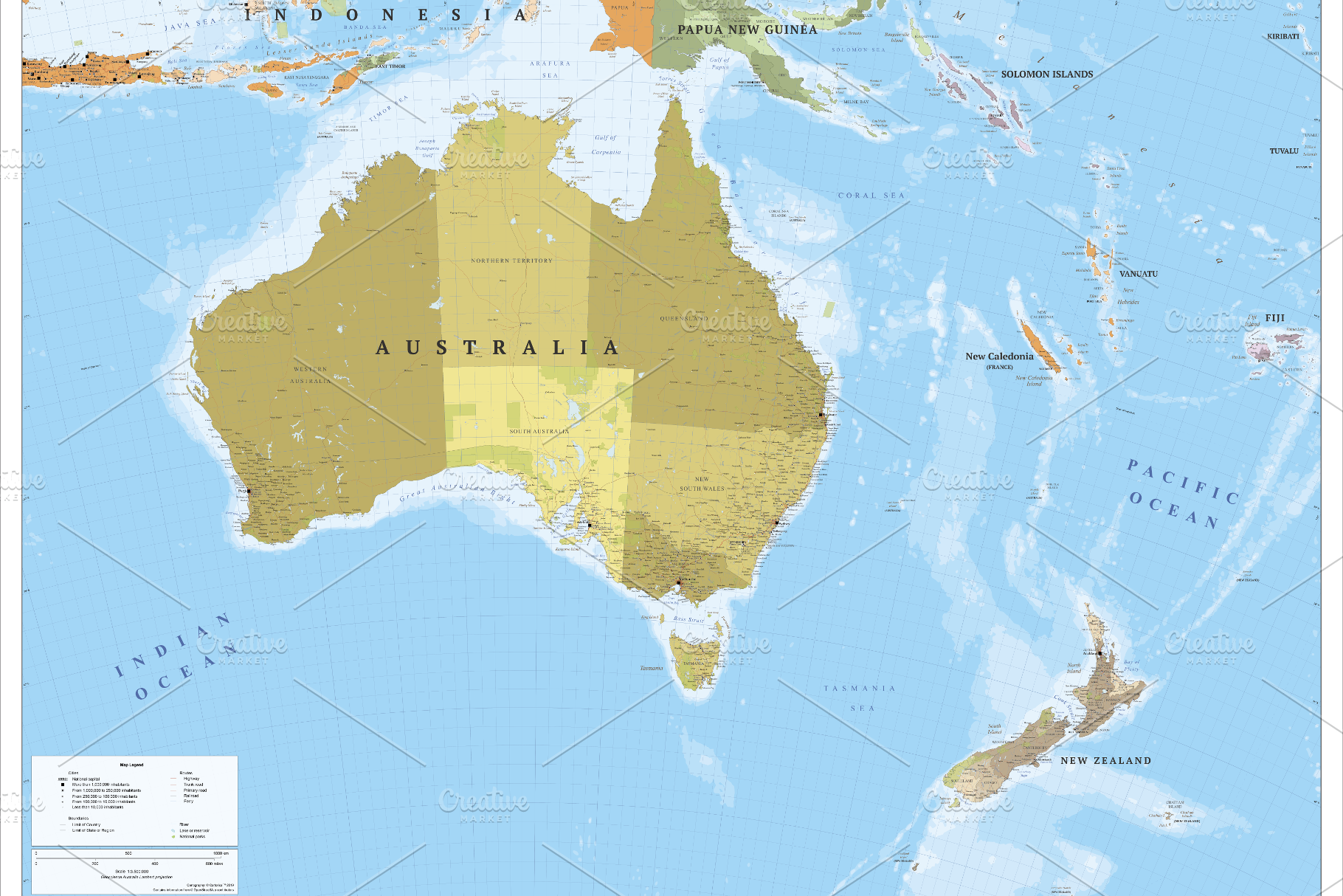
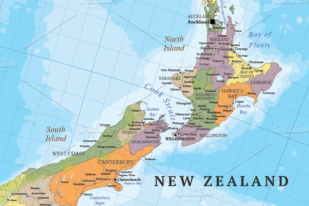
Large scale Australasia political map (Australia and New Zealand) multi-layered in editable vector format. Highly detailed, ideal for illustrations, prints and multimedia projects. 100% editable including font text for ease of use.
Map with towns, cities, major roads, railways and sea routes.
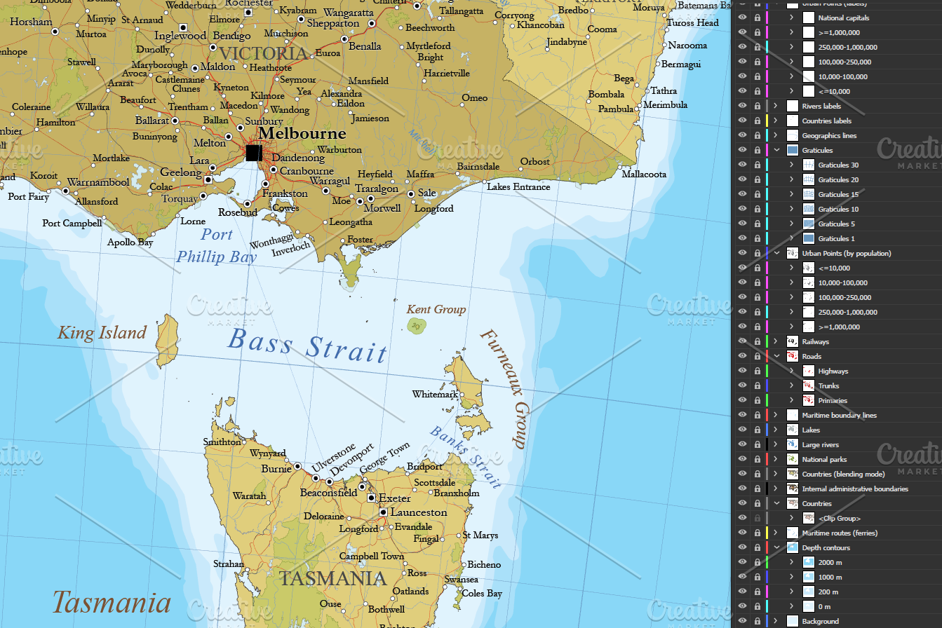
**Multiple thematic layers**:
- Coast lines and islands.
- Complete maritime routes.
- Countries (borders and fills in two styles).
- Countries names.
- Oceans and seas names.
- Depth contours.
- Rivers.
- Lakes and reservoirs.
- Geographic points names.
- Internal administrative boundaries (first-level administrative division).
- Internal administrative boundaries names.
- Capital cities.
- Major settlements (five levels layered by population).
- Motorways.
- Trunk roads.
- Primary roads.
- Railways of standard gauge.
- National Parks.
- Graticule with latitude/longitude.
- Map symbolization.
The design respect the rules and standards of cartographic composition with a style of colors and patterns consistent and creative. Adjacent polygons have not the same color, which helps the reader understand the map. All texts can be modified: real text, no outlines.
----
**Technical description**
- Vector elements distributed in **more than 40 thematic layers**.
- Labels in real text layered.
- **Languages:** English.
- **Projection:** Lamberts Conic.
- **Original scale:** 1:3,500,000
- **Dimensions:** 4A0 About (1682 x 2378 mm or 66.2 x 93.6 in). Scalable.
- **Formats:** Illustrator CC and Acrobat PDF.
- **Last updated:** May 2019 (free regular updates).
Map with towns, cities, major roads, railways and sea routes.
**Multiple thematic layers**:
- Coast lines and islands.
- Complete maritime routes.
- Countries (borders and fills in two styles).
- Countries names.
- Oceans and seas names.
- Depth contours.
- Rivers.
- Lakes and reservoirs.
- Geographic points names.
- Internal administrative boundaries (first-level administrative division).
- Internal administrative boundaries names.
- Capital cities.
- Major settlements (five levels layered by population).
- Motorways.
- Trunk roads.
- Primary roads.
- Railways of standard gauge.
- National Parks.
- Graticule with latitude/longitude.
- Map symbolization.
The design respect the rules and standards of cartographic composition with a style of colors and patterns consistent and creative. Adjacent polygons have not the same color, which helps the reader understand the map. All texts can be modified: real text, no outlines.
----
**Technical description**
- Vector elements distributed in **more than 40 thematic layers**.
- Labels in real text layered.
- **Languages:** English.
- **Projection:** Lamberts Conic.
- **Original scale:** 1:3,500,000
- **Dimensions:** 4A0 About (1682 x 2378 mm or 66.2 x 93.6 in). Scalable.
- **Formats:** Illustrator CC and Acrobat PDF.
- **Last updated:** May 2019 (free regular updates).
| Compatible with: | Adobe Illustrator |
| File Type: | PDF, PNG, AI |
| File Size: | 98.5 MB |
| Dimensions: | 6740 x 4767 px |