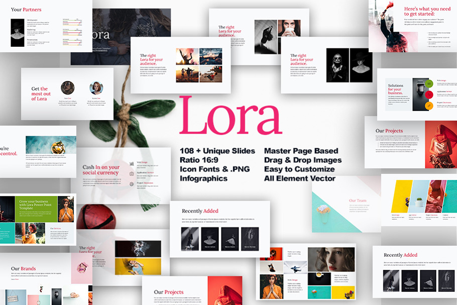
Lora presentation template
in Templates / Presentation Templates / PowerPoint Templates
DOWNLOAD NOW Report
73
0
YOU MAY ALSO LIKE:


High quality powerpoint maps of 106 countries. Each country is divided into states (regions, provinces, etc.). Also contains vector flags, map markers and navigation icons.
MAIN FEATURES:
- Over 106 countries
- Fully compatible with Microsoft PowerPoint
- All Objects are PowerPoint Vector Shapes
- Capitals, flags, icons and markers
Font used are all FREE:
- https://www.fontsquirrel.com/fonts/lora
MAIN FEATURES:
- Over 106 countries
- Fully compatible with Microsoft PowerPoint
- All Objects are PowerPoint Vector Shapes
- Capitals, flags, icons and markers
Font used are all FREE:
- https://www.fontsquirrel.com/fonts/lora
| Compatible with: | Powerpoint |
| File Type: | |
| File Size: | 10.4 MB |